| Columbian
Coast from Bahia Honda to Cartagena |
|
We have
benefited from the experience of the boat Pizzaz and updated by a
French yacht Likapati who have sailed along this coast rather than the
more usual route straight to Cartagena or to the San Blas archipelago.
This is therefore an account of the passage with other sailors in mind
and I have included waypoints and suchlike to help anyone interested.
We assume that people have been
steering clear of Colombia because of the country's dubious reputation
with drugs and kidnapping because the wind and sea conditions on the
straight route sound fairly horrific. We found the sailing close into
the coast very pleasant with moderate to light winds and the occasional
need to motor/sail to get into anchorages before dark. This latter
because none of our charts are detailed enough to risk night approaches. |
| Bahia Honda |
|
|
|

|
|
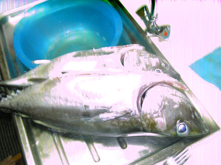
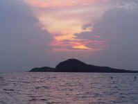
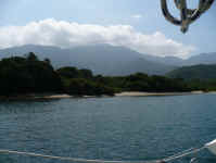
From Monjes we
left early in the morning and arrived in Bahia Honda in plenty of time
to creep carefully into this bay. It is very shallow round the northern
edge but the gently sloping sandy bottom meant that it was easy to get
into a protected anchoring spot.
This is the view to the northeast from inside the bay.
Spotted some large yellow jellyfish so decide not to go swimming.
Way Point
12° 23.548' N 71°
46.223' W
Anchored 12° 22.4' N
71° 45.5' W on sand in 2.5 meters
|
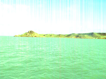
Ferloguen
had followed us and having been fishing en-route, Christophe gave us
another two tunas!
|
| Cabo de la Vela |
|
|
|
|
|
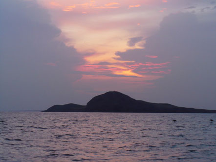
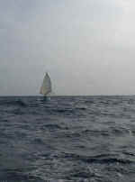
This was an nice
headsail run from Honda to Cabo de la Vela. We went round the small
island off the point but could have gone between the two. We anchored
around the point where there is plenty of room with a sandy bottom. We
spent a day here resting although the water was full of the jellyfish as
big as big as cauliflowers and bright yellow! So again we didn't swim
which was a shame as the water temperature are was 32°.
It seems that the warmer the water, the more jellies which is a pity. Way
Point
12°13.344
N 72° 10.910' W
Anchored 12° 12.3' N 72° 10.65 W on sand in 4 - 5 metres
|
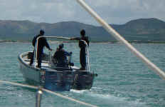
The Guarda
Costa came round to check us out but from the look of them they could
easily have been the FALC especially the guy with the balaclava and big
shades! They didn't actually check our papers, just bumped into the
boat, luckily only gently, and went away.
|
|
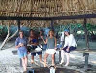
In Cabo de la Vela
we met another yacht, Don Quijote with Canadian and Austrian couple,
Laurence and Heidi. They are the source of most of these photographs for
which I am very grateful.
We and Christophe were invited for sundowners and we decided to all sail
on together.
|
|
|

|
|
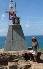
Heidi by the light on
top of Cabo de la vela
|
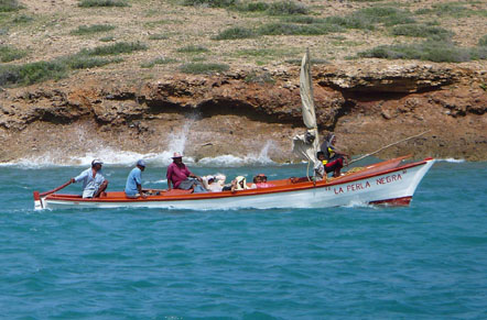
So we finally caught up
with the Black Pearl! Funny, she looks a bit different from when Captain
Jack Sparrow had her.
|
| Riohacha (Punta de
Vela) |
|
 |
|
So, from
Cabo de la Vela to Punta la Vela.
This is a departure from the route of the Pizazz guide. Rather than the
120 mile overnight trip to 5 Bays we decided to try and stop just after
the oil platform and just before the town of RioHacha. We crossed the
pipeline at the point marked by two light beacons although we would have
had a better angle of sail if we had gone to the north of the platform.
There was a small patch of reef showing on the charts and we thought it
would be fine to tuck in behind them for the night. This was a
reasonable idea and a better rest than an overnight sail although it was
a bit rolly. We didn't go in as far as we think we should have because
we were a bit concerned about the depths. A very friendly local called
Ruben came out with most of his family. He was very excited because we
were the first yachts that he had seen stopped there in the last 10
years. If we hadn't been in a hurry to get on we could have gone and
visited his home ( the blue house).
He spoke fairly good English having worked in Chicago for a while.
Way Point for crossing the oil
pipeline 11° 44.547' N 72° 43.115' W
Way Point outside
shoal 11° 39.53' N 72° 50.732' W
Anchored 11° 12.3' N 74° 13.8' W on sand in 2.5
metres
|
| 5 Bays - Bahia Cinto |
|
|
|
|
|
We left
Punta de Vela at 3 am and since the others had requested an alarm call,
Foss played Auld Lang Syne on the saxophone over the VHF channel that we
had been using to stay in contact with each other. Not really an
approved use of the VHF but terribly effective!
We had an excellent sail for most of the way with headsail and
goose-winged main. We had to motor/sail for the last 3 hours as the wind
had dropped and we had to get into the bay before nightfall.
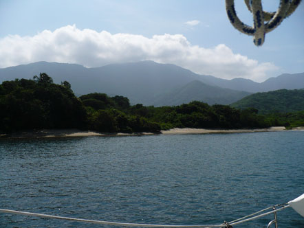
We tucked right into the north eastern end of the bay in a very
sheltered spot. This is a beautiful bay surrounded by green
mountains and looking very like Scotland when we arrived as it was
covered by lowering cloud. The water is clear and clean with no
jellyfish.
We had hardly got anchored when the heavens opened and violent thunder
and lightning surrounded us. I hurriedly wiped off the top of the
doghouse and Erik fitted up the water catching pipes so we could fill up
our water tanks.
|
|
|
|
|
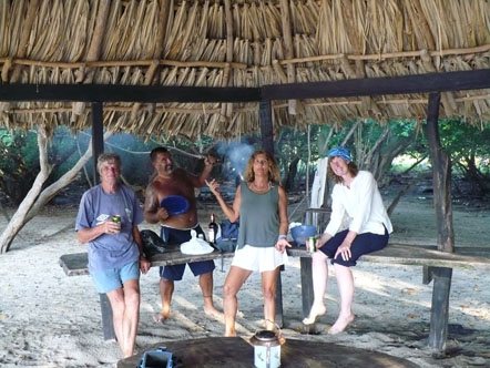
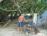
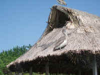
The mayor
of Santa Marta owns a house here with a palm-leafed kiosco on the beach.
We decided to borrow the kiosco and the attached barbeque for the
remainder of Christophe's fish and we all had a party. As the only
Frenchman, Christophe had to be chef!
Way Point
11°
21.119' N 74° 03.32 W
Anchored 11°
19.9 74° 03.1 N on sand in 5 metres
|
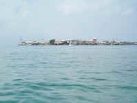
| Rodadero |
|
|
Don Quijote
decided to move to the third bay and stay there for a few days so after
another swim in the lovely clean waters of the bay we and Ferloguen set
off again to go round the corner, past Santa Marta to Rodadero beach.
Having parted company with Don Quijote there are no more photos unless
we meet up again.
We went between Isla Aguja
and the mainland. The passage is quite wide enough but there is a
semi-submerged rock in the middle of what the chart shows as a clear
channel. heading into the sun as we were it was nearly invisible and
gave us a bit of a surprise!
The route through that we took is as follows:
Way Points
11° 18.855' N 74°
10.957' W
11° 18.591' N 74° 11.285' W
11° 18.479'
N 74° 11.394' W
11° 18.375'
N 74° 11.516' W
11° 18.214
N 74°11 .739' W
On the way into Rodeadero Bay you pass a large rock which is covered in
numerous strange buildings with spiral stairs and balconies like the
prows of ships but all slightly ruined and looking rather like an
illustration from Lord of the Rings. This anchorage is rather a culture shock from
peaceful Bahia Cinto with the high rise hotels, loud disco music and speed
boats and the like screaming round the bay. However it was a reasonable
overnight stop before the Rio Magdalena crossing.
Way Point
11° 12.366'
N 74° 14.461' W
Anchored 11° 12.3'
N 74° 13.8' W on sand in 4 metres
but sharply shelving
|
| Punta Hermosa |
|
|
At
3am (again!) with the disco music still pounding, we left Rodadero. Up
till now the winds had been light but already the wind was freshening.
By dawn we had 20-25 knots of wind on the stern quarter and a big swell
with breaking waves. This was a bit unnerving as we knew we had to be a
bit careful crossing the mouth of the Rio Magdalena. This river is the
biggest river in Colombia and a lot of debris is brought down from the
mountains and spilled out into the sea..
We had planned to cross about 2-3 miles out from land but in light of
the weather we decided to stay out roughly at the 200 metre line to
avoid the steepness of the waves in the shallower water.
We had been warned to look out for logs and floating rafts of vegetation
that had been washed down the river. What we hadn't been warned about
was the sudden interface between the outflow and the sea. As we
approached, we could see what looked like a low shore or reef dead
ahead!
As we got nearer and the brown line became clearer we could see that it
was the muddy river water. As we crossed the sharp dividing line between
ocean blue and river brown, we were swung violently to starboard,
heeling right over and heading off-course by 30°
or more!
However, after a few minutes, the river current actually calmed the
waves down significantly and the current helped us on our way to Punta
Hermosa.
There were lots of way points provided by other sailors for this
anchorage, mostly because the sand bar does not appear on any charts
even though it has beach huts and even larger buildings on it!
This following course worked for us. Basically it is an area of variable
shallows with a sandy bottom and you have to keep an eye on the depth as
you come in.
As you come round into the bay, the sand bar and the beach look like
they have giant strips of corrugated cardboard laid along them. These
are long rows of palm-thatched beach shelters which on a rather windy
and cool Saturday were pretty deserted. We went as far up the bay as we
reasonably could with a slowly shelving sandy bottom.
Way Points
10°
57.074 N 75° 03.701'W
10° 55.629 N 75°
02.937 W
10° 55.995 N 75° 02.427 W
Anchored 10° 56.7' N
75° 01.7'W on sand in 2.5 metres
|
| |
|
|
Cartagena
|
Apart from giving Punta Canoas a wide berth, the trip to Cartagena was a
straight-forward downwind run. The crossing point of the submerged wall
across the harbour mouth is marked with red and green buoys that you can
see, with binoculars, from the waypoint.
Way Point 10° 25.361 N 75°
34.717' W
|
|
CARTAGENA
|
|
After
Cartagena we decided to continue on down the Colombian coast as far as
possible before crossing to the San Blas Archipelago. Foss bought a new
camera in Cartagena so we have pictures again. We did meet up with Don
Quijote again when they limped into Cartagena a few days after us with a
dead gear box and having been struck by lightening in Bahia Guayraca! We
hadn't the heart to pester them for more photos even if they had
actually had time to take any. Apparently, after we left them, the wind
increased a lot, gusting up to 50 knots in the bay which wasn't as well
protected as Bahia Cinto.
The lightening strike burnt out the aerial/radio and maybe the depth
sounder but apparently not too much else. It could have been much worse
and we felt very lucky that we had pressed on with the trip rather than
waiting. Thank you Sue for the weather forecast!
We make a habit of keeping all the electronic devices, that are
not permanently attached, in the oven which should be an effective Faraday
cage should we be struck by lightening. That way we should be
left with a few functioning gismos if the worst happens.
|
| Islas Rosarios ( Isla
Grande )
|
|
|

|
|
|
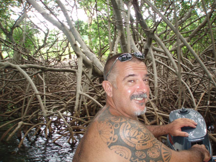
Christophe decided to accompany us
at least as for as the border with Colombia. He is headed for Costa Rica
but his boat, Ferloguen, is not suitable for big seas so coastal hopping
seemed like a better idea. |
Our dingy got
punctured by the dinghy dock at the Club Nautico in Cartagena so
Christophe is being our ferry service to allow us to go sightseeing. |
|
Our chart is
not at all accurate for depths round here so we came in fairly
cautiously. The following worked for us ( we didn't want to go to the
main harbour)
We were in deep water until the last moment when it was suddenly 2
metres.
Way Points
10° 11.0383' N 75° 41.575' 'W
10° 10.583' N 75°
42.059' W
10° 10.142'
N 75° 42.853' W
10° 10.169'
N 75° 43.873' W
10°
10.089' N
75° 43.372' W
10° 10.215'
N 75° 43.812'
W
Anchored 10° 10.472' N
75° 43.954' W on sand and scattered coral in 12
metres
|
| Islas Bernados ( Isla
Tintipan )
|
|
|
|
|
|
It seemed odd that all the larger
islands were empty and all the village crowded into one tiny island. |
There were also quite a few big
fancy houses owned by rich Colombians.
Holiday homes? |
|
Anchored 9
We left
by a different route which gets safely through a narrow gap in the
surrounding reef
Way Points
9°
46.825 N 75° 51.015 W
9°
46.577 N 75° 50.584 W
9°
45.192 N 75° 50.715' W
9°
43.116 N 75° 50.110' W |
| Isla Fuerte
|
|
|
|
|
Antonio paddled out as we were
arriving and guided us through between the large underwater rocks that
were all around this anchorage and the next morning he sold us some red
snappers.
9°
23.09' N 76° 10.028'W
9° 23.09' N 76° 10.119' W
9° 23.059' N 76° 10.160' W
9° 23.060' N 76° 10.280'W
9° 23.098' N 76° 10.370' W
9° 23.143' N 76° 10.410' W
Anchored 9° 23.125' N 76° 10.44' W |
|
NEXT FISH IN PANAMA
|